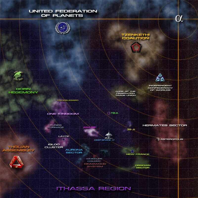
Ithassa Map
Legend
- One Kingdom - 13 systems populated by the multi limbed Constellationites.

|
| Ithassa Region (Map, Stellar Cartography) |
|---|
| Major Neighboring Powers |
| Governments & Alliances |
|
| Known Races |
| Starfleet Presence |
|
- Igloo Cluster - 93 compact systems and home to the Grendellai.
- Aurona Sector - A dangerous area of the Ithassa region with several nebula and uniformly poor communications and sensors.
- Deep Space 17 - Starfleet's central command for the region, which orbits the neutron star known as Eratis
- Eratis - The Vulcan Harp Nebula (mislabelled), is home to the stable end of a roaming wormhole.
- 3A9 - A system with a M class world populated by a Tzenkethi research facility.
- T8A - is an uninhabited tropical paradise according to unmanned probes. On 238404.30 exploration of the planet was begun by two Starfleet Security Officers from the USS Triumphant - Kassa Quay and Thompson Kirby. The explorers renamed the planet Planeta del Amor
- Wheeler Colony - An old mining colony in the Deadwood System.
